• 0Shopping Cart
MapCo NZ Ltd - Maori, Pacific Island and New Zealand Maps
  • Home
  • About Us
  • Shop
    • New Zealand
      • New Zealand
      • Regions
      • Marine
      • Topographical
      • Atlases
      • Folded
      • Others
    • Maori
      • Maori Maps
      • Maori Books (Pukapuka)
    • Pacific Islands
      • Pacific Ocean & Islands
      • Others
    • World
      • World Maps
      • Atlases
      • Folded
    • Countries & International
      • Countries
      • Continents
      • Atlases
      • Others
    • Speciality
      • Religious
      • Tectonic Plates
      • Others
    • Charts & Posters
      • Music
      • Human Body
      • Solar & Space
      • Animals
      • Early Learning
      • Others
    • Globes
      • Illuminated
      • Table Globes
      • Inflatable Globes
      • School Globes
  • Testimonials
  • Contact Us
  • 0276410665
  • Search
  • Menu Menu
  • Facebook

New Zealand Executive

$75.00 Excl G.S.T $86.25 Incl G.S.T

Out of stock

SKU: NZ022 Category: New Zealand Tags: Antique, Brown Map, Excecutive, New Zealand, NZ Map, Old Map
  • Description

Description

600mm x 770mm

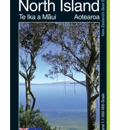
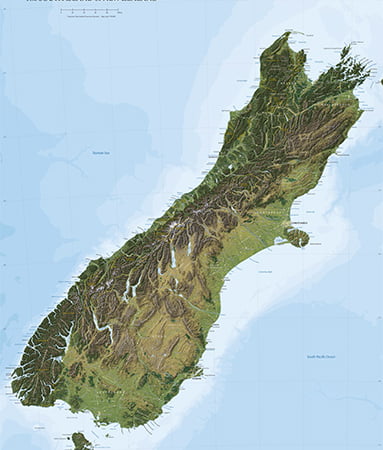
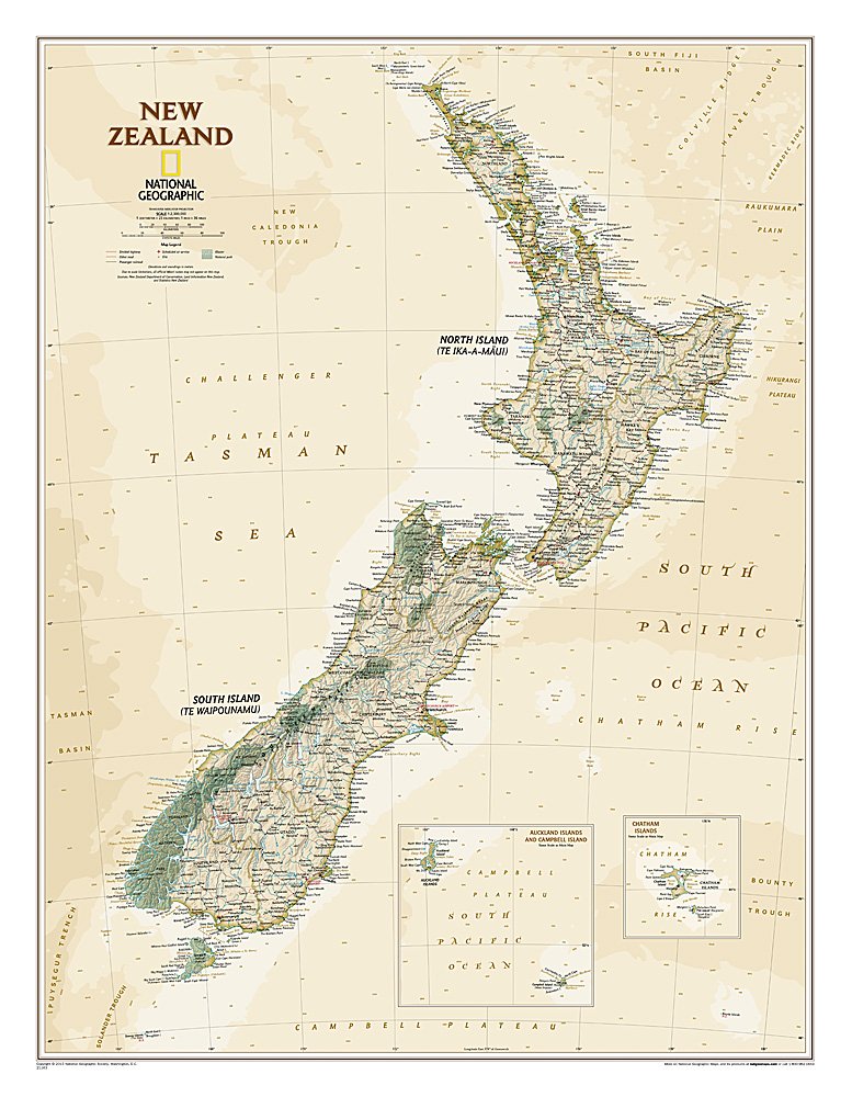
Beautiful Map. The reference map of New Zealand uses National Geographic’s Executive style with an antique-style color palette and stunning shaded relief. The map shows this island nation in great detail, from the subtropical North Island (Te Ika-a-Maui) to the glacial carved valleys of Fiordland on the South Island (Te Waipounamu). The North Island is best known for large volcanic lakes and the cities of Auckland and Wellington. The South Island is famous for the Southern Alps that run along the spine of the island. The highest point in the country is Aoraki (Mount Cook) and is found in the Southern Alps.The first settlers of New Zealand were the Maori from Polynesia, the names on the map reflect this history with both English and Maori variants. The map also features a transportation network including highways, roads, passenger railroads, and major airports. All National Parks are also shown.The map is packaged in a two inch diamater clear plastic tube. The tube has a decorative label showing a thumbnail of the map with dimensions and other pertinent information.

MATT LAMINATION FINISH

Related products

  • North Island Kiwi Map PAPER

    $25.00 Excl G.S.T $28.75 Incl G.S.T
    Add to cart Show Details
  • REG250-6_NZ_Rural_Road_Map_Taranaki_Ruapehu

    Taranaki & Ruapehu

    $45.00 Excl G.S.T $51.75 Incl G.S.T
    Add to cart Show Details
  • REG250-4_NZ_Rural_Road_Map_Waikato_Bay_of_Plenty

    Waikato & Bay of Plenty

    $45.00 Excl G.S.T $51.75 Incl G.S.T
    Add to cart Show Details
  • NZ25202_The_Large_South_Island

    The Large South Island

    $150.00 Excl G.S.T $172.50 Incl G.S.T
    Add to cart Show Details

MapCo NZ Maps
MapCo NZ Ltd
New Zealand, Maori, Pacific and International
Maps and Globes

Enquires to [email protected]

Please see our Website www.mapco.co.nz

Leon Smith 0276410665


Contact Us

[email protected]

0276410665

© Copyright - MapCo NZ Ltd
  • Facebook
Consulate Globe – 30cm Islands in American Samoa Marine Chart NZ8685
Scroll to top