• 0Shopping Cart
MapCo NZ Ltd - Maori, Pacific Island and New Zealand Maps
  • Home
  • About Us
  • Shop
    • New Zealand
      • New Zealand
      • Regions
      • Marine
      • Topographical
      • Atlases
      • Folded
      • Others
    • Maori
      • Maori Maps
      • Maori Books (Pukapuka)
    • Pacific Islands
      • Pacific Ocean & Islands
      • Others
    • World
      • World Maps
      • Atlases
      • Folded
    • Countries & International
      • Countries
      • Continents
      • Atlases
      • Others
    • Speciality
      • Religious
      • Tectonic Plates
      • Others
    • Charts & Posters
      • Music
      • Human Body
      • Solar & Space
      • Animals
      • Early Learning
      • Others
    • Globes
      • Illuminated
      • Table Globes
      • Inflatable Globes
      • School Globes
  • Testimonials
  • Contact Us
  • 0276410665
  • Search
  • Menu Menu
  • Facebook

Cook Islands & Tahiti

$65.00 Excl G.S.T $74.75 Incl G.S.T

SKU: NZ048 Categories: Others (International), Others (Pacific), Pacific Ocean & Islands Tags: Cook Islands, Islands, Pacific, Pacific Ocean Islands, Tahiti
  • Description

Description

1000mm x 690mm

Double sided Map

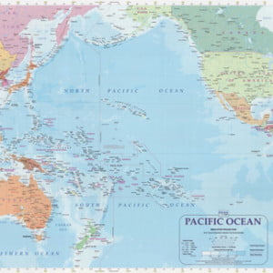
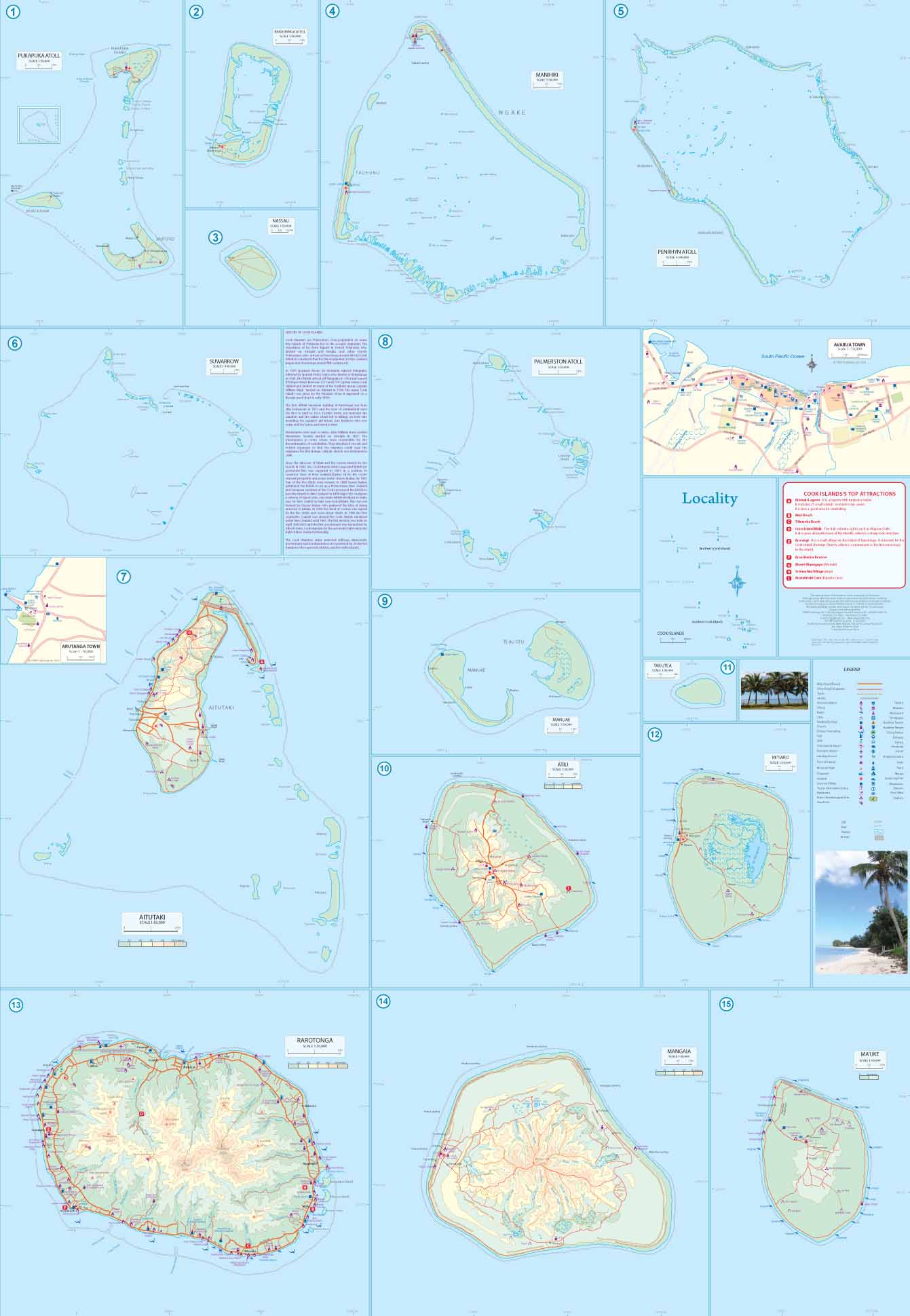
This time around, we are combining Tahiti with the Cook Islands. Both share the reality of island countries – they consist of a series of islands separated by vast distances of water. To show off Tahiti to advantage, we have mapped the islands at 1:100,000 scale, with a nice inset map of Papeete, the capital. The main island is actually two islands joined by a narrow isthmus called, appropriately Nui and Iti (large and small) Most of the resorts seem to be located south of Papeete. There are three other medium-sized islands – Moorea, Tahaa, and Raiatea, and the well-known coral enclosed island of Bora Bora. We have provided an inset map of the territory (technically, it is part of France and uses the Euro). The Cook Islands tend to be smaller and less mountainous. The main island is Raratonga and we have added an inset map of Avarua, the country’s capital. Other touristic islands are Aitutaki, Mangaia, and Atiu, although my favourite is the isolated island of Penrhyn. Historically, the first sighting of any of the islands occurred as early as 1595, but real contact began in 1814, rather unhappily, with fighting and the deaths of individuals on both sides. With the French claiming control of Tahiti and the Society Islands, the island chiefs appealed repeatedly to Britain for protection. This was finally agreed to many years later, but Britain soon transferred responsibility to New Zealand. The islands have been self-governing since 1965.

MATT FINISH LAMINATION

ORDER IN ITEM – MAY REQUIRE 1-2 WEEK WAIT

Paper folded available on request

Related products

  • Treaty_Of_Waitangi

    Treaty of Waitangi Chart

    $55.50 Excl G.S.T $63.83 Incl G.S.T
    Add to cart Show Details
  • Australia Planning Map

    $25.00 Excl G.S.T $28.75 Incl G.S.T
    Add to cart Show Details
  • NZ008_Pacific_Ocean_with_Islands

    Pacific Ocean with Islands Map

    $160.00 Excl G.S.T $184.00 Incl G.S.T
    Add to cart Show Details
  • World Planning Map

    $25.00 Excl G.S.T $28.75 Incl G.S.T
    Add to cart Show Details

MapCo NZ Maps
MapCo NZ Ltd
New Zealand, Maori, Pacific and International
Maps and Globes

Enquires to [email protected]

Please see our Website www.mapco.co.nz

Leon Smith 0276410665


Contact Us

[email protected]

0276410665

© Copyright - MapCo NZ Ltd
  • Facebook
Tonga & Fiji North Island Kiwi
Scroll to top