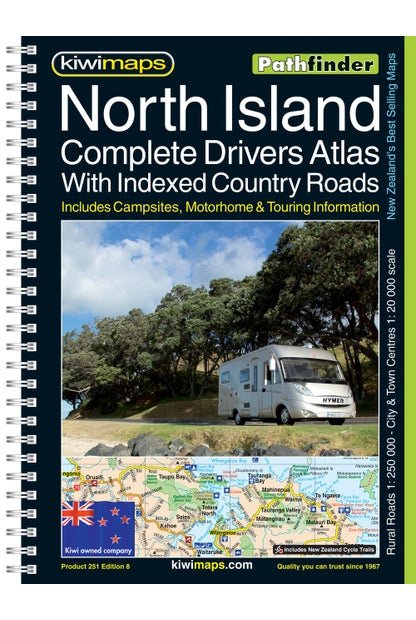
• 0Shopping Cart
MapCo NZ Ltd - Maori, Pacific Island and New Zealand Maps
  • Home
  • About Us
  • Shop
    • New Zealand
      • New Zealand
      • Regions
      • Marine
      • Topographical
      • Atlases
      • Folded
      • Others
    • Maori
      • Maori Maps
      • Maori Books (Pukapuka)
    • Pacific Islands
      • Pacific Ocean & Islands
      • Others
    • World
      • World Maps
      • Atlases
      • Folded
    • Countries & International
      • Countries
      • Continents
      • Atlases
      • Others
    • Speciality
      • Religious
      • Tectonic Plates
      • Others
    • Charts & Posters
      • Music
      • Human Body
      • Solar & Space
      • Animals
      • Early Learning
      • Others
    • Globes
      • Illuminated
      • Table Globes
      • Inflatable Globes
      • School Globes
  • Testimonials
  • Contact Us
  • 0274 925 662
  • Search
  • Menu Menu
  • Facebook

North Island Drivers Atlas A4

$35.00 Excl G.S.T $40.25 Incl G.S.T

SKU: ATL009 Categories: Atlases (NZ), Others (NZ) Tags: Atlas, Book, North Island, raod Book
  • Description
  • Additional information

Description

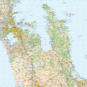
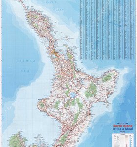
New Zealand’s North Island Road Atlas: spiral, handy size (19x26cm), 185-page road atlas with enlargements for environs of main towns, street plans of town centres, an extensive index of localities, roads/tracks and streets, plus information driving regulations. The main section of the atlas covers the North Island at 1:250,000, with very detailed presentation of the road network from motorways to 4WD tracks. Railway lines, ferry routes, local airfields and airstrips are marked. National Parks and protected areas are highlighted, and symbols mark places of interest, a very wide range of sport and recreational facilities, wine growing areas, hot springs and thermal areas, campsites and motorhome/caravan parks, etc. Selected waking tracks are also shown, including the New Zealand Walkway and the Te Araroa Walkway. Topography is indicated by very effective relief shading, spot heights and names of various mountain ranges, plus colouring for protected areas. No geographical coordinates are provided.

  • Publication Date: 22/12/2005
  • 258 x 186mm
  • Bookmap, A4

Additional information

Dimensions190 × 260 mm

Related products

  • REG250-7_NZ_Rural_Road_Map_Hawkes_Bay

    Hawkes Bay

    $45.00 Excl G.S.T $51.75 Incl G.S.T
    Add to cart Show Details
  • Napier Harbour Marine Chart

    $50.00 Excl G.S.T $57.50 Incl G.S.T
    Add to cart Show Details
  • REG250-2_NZ_Rural_Road_Map_Northland

    Northland

    $45.00 Excl G.S.T $51.75 Incl G.S.T
    Add to cart Show Details
  • Motiti Island to Pehitahi Point Marine Chart

    $50.00 Excl G.S.T $57.50 Incl G.S.T
    Add to cart Show Details

MapCo NZ Maps
MapCo NZ Ltd
New Zealand, Maori, Pacific and International
Maps and Globes

VISIT OUR SHOP

Visit Our Showroom:

OPEN MOST DAYS NOW  9am onwards pop in anytime

SORRY CLOSED 29 Nov until 2nd December due to bereavement 

PHONE JUDE if you would like to make a time to be sure store is open before travelling there.

We can open for you at most times if  we are available

0274 925 662

6 Maranui Street, Mt Maunganui, New Zealand


Contact Us

Jude Habib – 0274 925 662
Office – 07 574 5522 (between 9am – 3pm)
[email protected]

© Copyright - MapCo NZ Ltd
  • Facebook
South Island Kiwi Map PAPER South Island Drivers Atlas A4
Scroll to top